I am so thankful for time to get together with other librarians to learn. We recently had a professional learning day in our district where many of our school librarians/media specialists shared how they are using Google apps with students. The amazing Tanya Hudson, librarian at Chase Street Elementary, shared how gadgets could be embedded in Google forms. She had used this tool with a 1st grade Common Core lesson using the book How to Make an Apple Pie and See the World. Her sharing made my brain wheels start turning about how this gadget might be used with other projects.
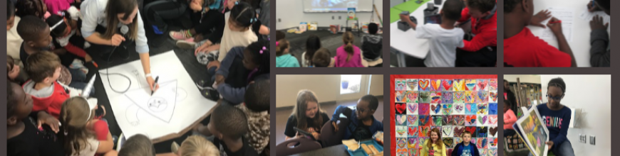
Our 4th grade is currently studying Native Americans. Their standards have them look at how location and environment affect the food, shelter, and clothing of groups of Native Americans in each region of the United States. Once again, I used a transliteracy model to think about all of the ways that students could experience these 6 groups of Native Americans. I pulled informational books, folk tales, and stories from each group and put them at tables. In the computer lab, students used a pathfinder which included Youtube videos, databases, and informational sites on clusters of Native Americans but also group-specific information as well. Students used a graphic organizer to gather their information.

Filling out the Google form
For the portion inspired by Tanya Hudson’s work, I created a Google form and asked 2 questions: What is the Native American group you discovered? and What is their location? I used 2 iPads as a station in the library where students could go and input thisinformation as they discovered locations in their research. I also embedded a map gadget in the form so that each time a student filled out the form, it pinned a location on a Google map. This map was displayed on the smart board. As the map started to populate, students began exploring what other students had posted onto the map, and an interesting thing happened. Students quickly discovered that students were entering incorrect information. The coolness of the iPad was causing some students to skip their research or type what they “thought they knew” into the form. The great thing was that other students started to call them out on this error. Other students discovered that you had to be specific on the location. Simply typing “southwest” did not necessarily put a pin in the right place of the map. Students began looking for specific states or, even better, specific cities. Our time simply wasn’t long enough, but a logical next step would be to have students begin to weed through the information in the form and decide what is valid and what is not. The data can be easily erased and disappears from the Google map. I already have one student who is interested in doing this by himself, but I think a whole class exploration would also be great because it lends itself to authentic conversation about why we do research in the first place.

Google map with pins
Once again in this experience I allowed students to freely move from place to place. Most migrated and remained at computers, while others stayed at the books for the majority of their time. Students who went to the books commented on how much information was in one place rather than having to look at multiple places on the computer. It was interesting to hear this come from them rather than me telling them myself. So many interesting conversations and teachable moments occurred and I wished that our time could be extended. This will be helpful in future planning to schedule multiple sessions or longer sessions with classes. In all, I think students gathered enough information collectively that they can share their information back in the regular classroom.

[…] used a Google Form to track where different tribes of Native Americans were located. Visit the Barrow Media Center blog to read more about […]
[…] various folktales are from. Then, I could have embedded a gadget to put a pin on a world map (like I did in this lesson) to track where our folktales were from. This might be an addition for next […]